
Click here to see a larger PDF version of this diagram with links to related documents
Click here to see a larger PDF version of this diagram with links to related documents
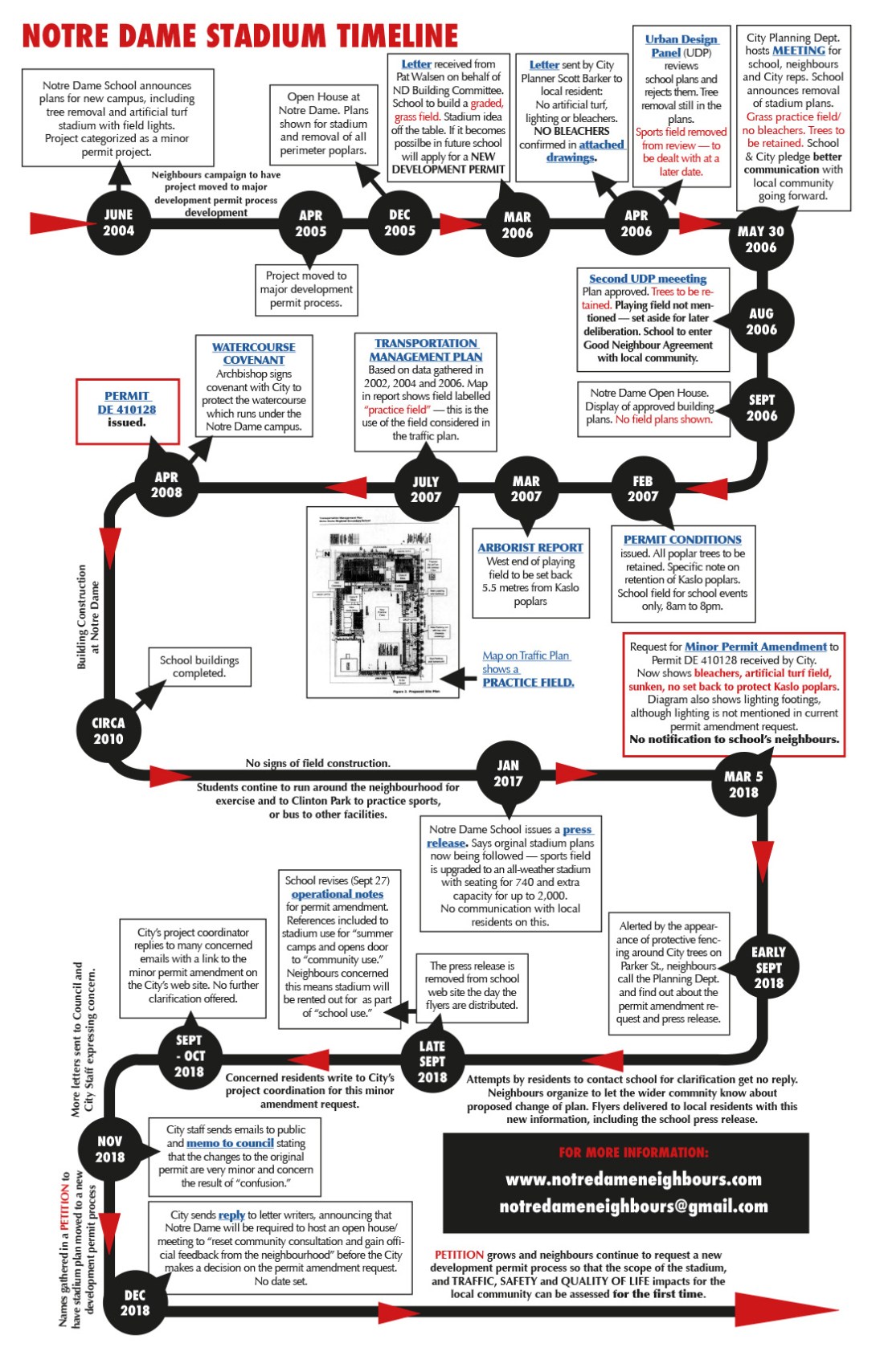
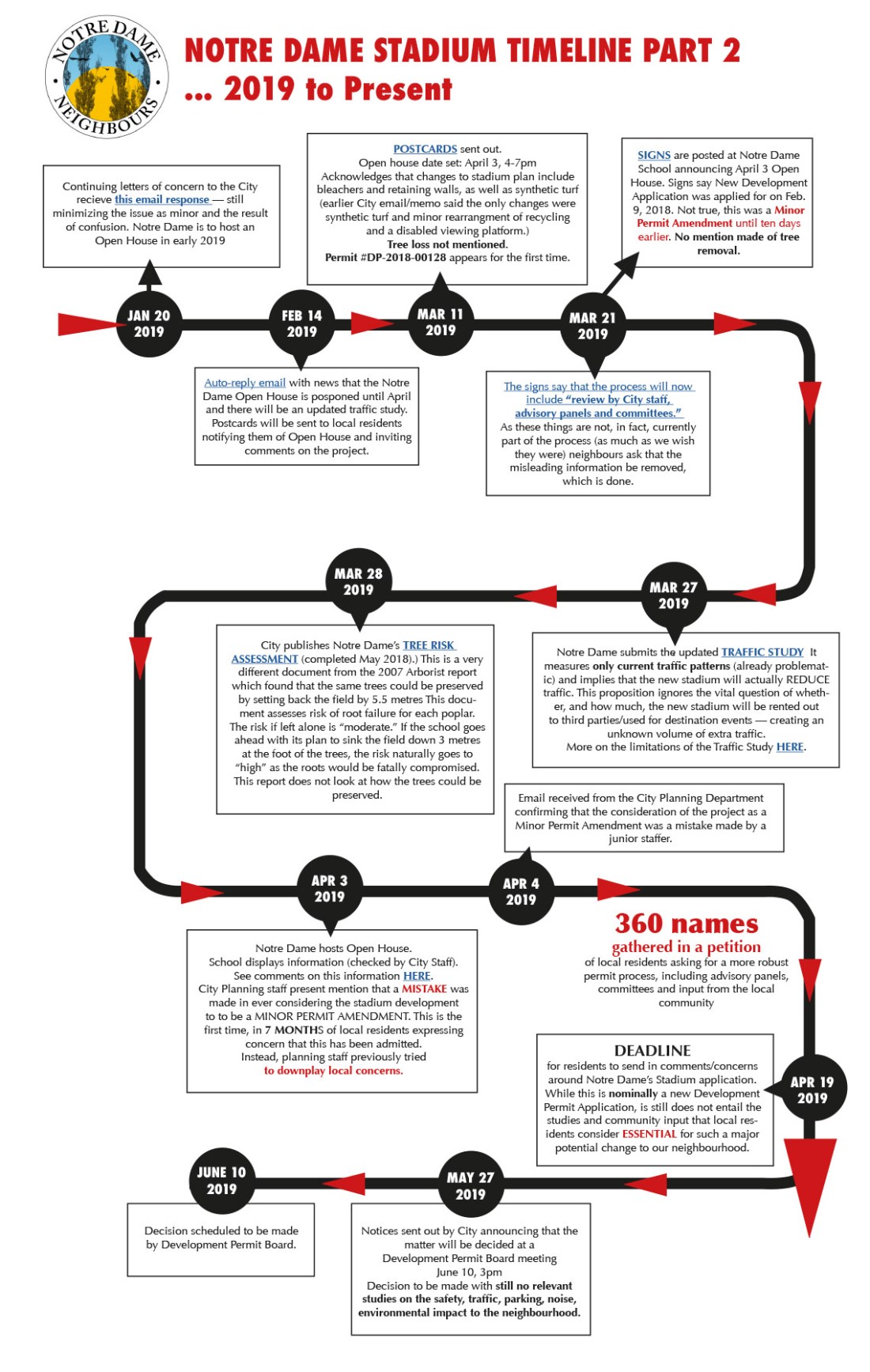
How the Notre Dame sports field went from a grass practice field to the much more extensive McCarthy Stadium is complicated. The diagrams above provide a simpler way to understand what happened.
Several things become clear, including the fact that in March 2006 the school withdrew its plan for a stadium and told residents that, if they did eventually decide to revisit the idea, they would apply for a new permit. They have not done this. Instead they are asking for a minor amendment, a process that doesn’t allow for proper public consultation and input.
The City of Vancouver’s Urban Design Panel did not discuss the field as it was removed from consideration (as promised by Notre Dame) in April 2006.
Another critical point is that the stadium and its potential impacts on traffic safety, parking and quality of life for the community have NEVER been studied. The existing Transport Management Plan was written over 12 years ago and assumes the installation of a grass practice field. A practice field brings minimal extra traffic, whereas a field for games becomes a destination with a far greater impact on the local area.
The series of events outlined in the diagram shows the need for a NEW BUILDING PERMIT PROCESS to look at all aspects of the proposed stadium and the effect it would have on our community.

One thought on “Notre Dame Stadium Timeline”